The passage plan your whole crew can draw
Most passage plan templates are a sheet of paper. A printed form with columns for waypoints, distances and times, filled in by one person the evening before and handed round in the morning. It works right up to the moment somebody wants a say. In Skipper Connect the passage plan sits on a chart that is open to everyone on the trip: each person draws their own suggestion, adds the places they want to see, and every route shows its distance in nautical miles as soon as the line is finished.
One chart, open to everyone
Satellite chart, free route drawing, shared points of interest. Ready for planning with the whole crew.
- Draw routes and adjust them afterwards. Point by point, and always clear who drew them.
- Distances are worked out automatically. Every route shows its nautical miles in the list, with the name of its author.
- Points of interest with category, name and note. Anchorage, harbour, restaurant, sight and other, visible to the whole crew.
One day, different suggestions
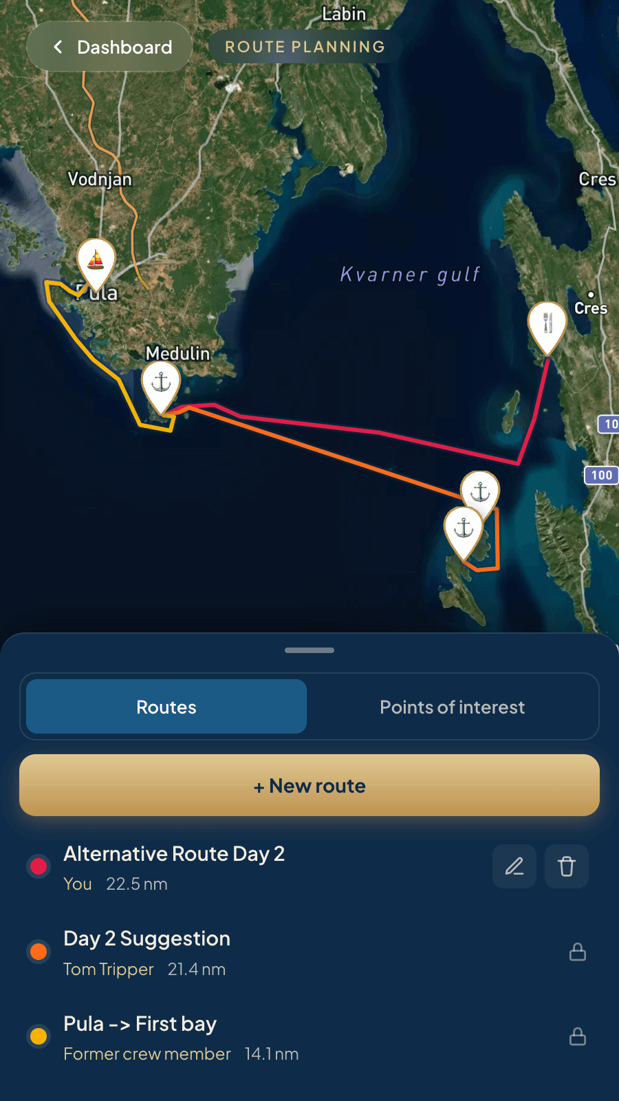
Wind, sea and weather can change quickly. So can what the crew wants. That is why the passage plan in Skipper Connect is not one person's job: everyone draws their own suggestion, adjusts it and puts it up for discussion. The decision is made together with the skipper. It works the other way round too. The skipper draws, and the whole crew sees straight away what is planned.
| Suggested by | Distance | Time at 5 knots |
|---|---|---|
| Sven, skipper | 14.1 nm | just under 3 hours |
| Chris, co-skipper | 21.4 nm | a good 4 hours |
| Carl, crew | 22.5 nm | four and a half hours |
The app works out the distance itself as soon as the line is drawn, to one decimal place. No table of distances between harbours, no straight line: it measures the route that was actually drawn, even where it curves around an island.
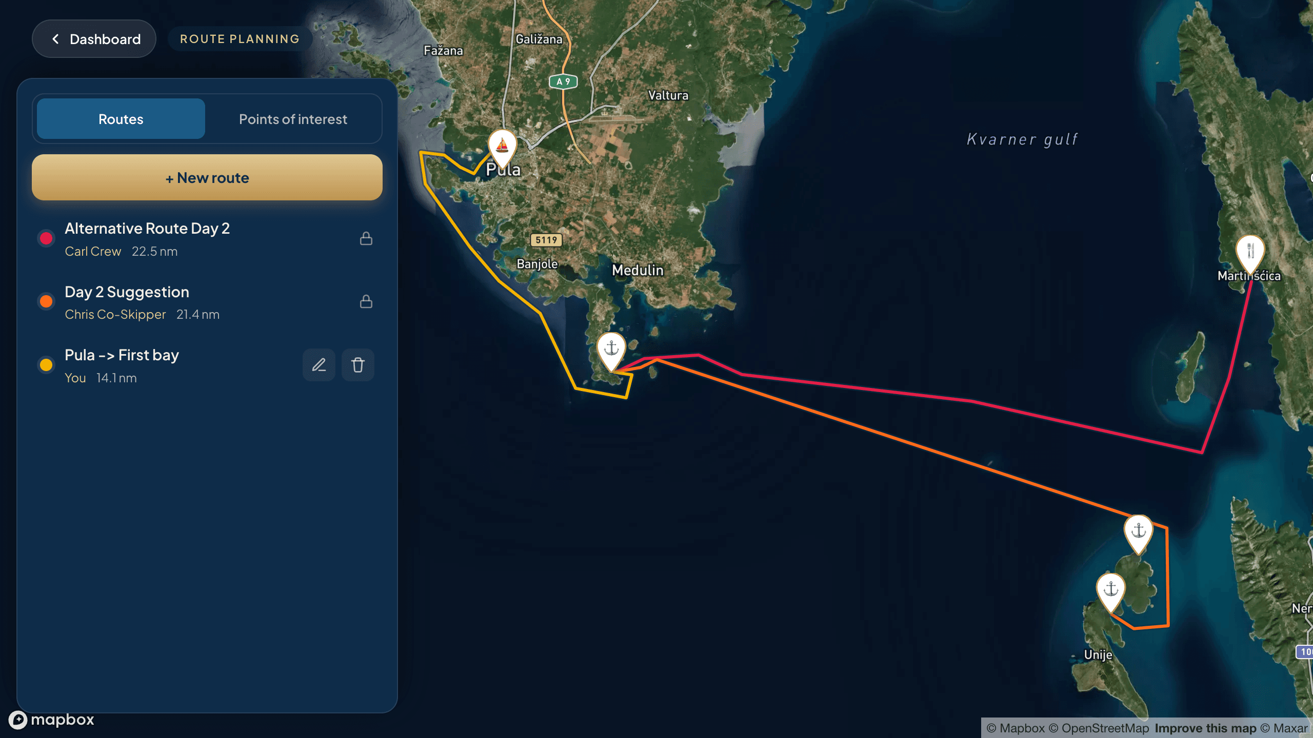
Every route carries the name of the person who drew it, in that person's colour.
Passage planning has never been this easy
Agree on the best route together with the crew. Share any changes with everyone quickly and easily.
How the crew plans together
Route planning is usually a one-way street. One person plans, everyone else just gets told. Here anyone on the trip can draw.
Everyone draws their own suggestion
Start, waypoints and finish go on the chart, and every point can be dragged afterwards. If someone has a shorter or longer version in mind, they simply put it alongside.
Every route shows its distance
So you can compare two suggestions without measuring anything. 14 miles or 22 is the difference between a long breakfast and an early start.
Everyone sees everything, nobody overwrites
Each person has their own route colour. You can only edit and delete your own entries. Even the skipper cannot clear away a crew member's suggestion, although the final say is still theirs.
The highlights first, then the passage
Most routes are not drawn on a blank chart. They grow out of the places the crew actually wants to see. That is what points of interest are for: everyone marks what matters to them. The bay from the pilot book, the restaurant from last year, the harbour with the yard, the island somebody joined the trip for in the first place. Once there are enough points of interest, you can plan the passage from one to the next, weather permitting.
Anchorage
The bay with the sandy bottom, where you lie safely.
Harbour
Marina or town quay, with power, water and a shower.
Restaurant
The evening that is worth an extra hour under way.
Sight
The cave, the fortress, the place that is not on any chart.
Other
Fuel dock, supermarket, mooring buoy etc.
Every point of interest gets a name, a note and the name of the person who added it. So the crew sees not only where the trip could go, but also what matters to whom.
Your favourite places on one chart for everyone
Plan your passage around the places you want to see and share it with the whole crew.
What is different about a route on the water
A few things worth knowing before the first line goes on the chart.
20 to 30 miles is a day
A charter yacht realistically sails at four to six knots. 25 nautical miles is around five hours on the water, plus casting off, coming alongside and finding a berth. With an inexperienced crew it is worth staying under that for the first few days, so the mood on board stays good.
Bay or harbour decides the evening
The anchorage is quiet, usually free and has no shower. The harbour costs money and has power, water and a restaurant on the quay. Both in the same week is normally the best mix, and that choice is easier when the crew's bays and harbours are already on the chart as points of interest.
The way back is the hard part
The route has to lead back to the base on the last day, often with the wind on the nose and always by a fixed time. So it pays to put the longest leg early in the week and count the return in from the start.
A suggestion is not yet a plan
Wind, sea and what the crew feels like change daily. Rather than fixing the whole week, it is easier on everyone to have a second version ready for the critical days. Both suggestions then sit side by side in the list, each with its distance. The final say always belongs to the skipper.
Common questions
Does the app work out the nautical miles automatically?
Yes. As soon as a route is drawn, its length appears in the list in nautical miles, to one decimal place. Move a point and the figure moves with it.
Is this a passage plan template I can download and print?
No. This is a chart, not a form. A printed template goes out of date the moment somebody changes their mind, and it cannot show what the rest of the crew had in mind. Skipper Connect keeps the plan where everyone can see it and change their own part of it.
Is there a distance table between harbours?
No, and that is deliberate. Those tables usually give the straight-line distance. Skipper Connect measures the route you actually drew instead.
How many miles can you cover in a day?
Twenty to thirty nautical miles is a comfortable size for a holiday trip, which is roughly four to six hours under way. On a mile-building trip the days are considerably longer, but there is less time left for the bay.
Does this replace a chart or a navigation app?
No. Route planning in Skipper Connect is for agreeing the plan on board, not for navigation. Shallows, buoys, restricted areas and current chart information belong on the plotter or in a charting app. If you want to agree the route, you are in the right place. If you want to navigate, you are not.
Can the crew really join in?
Yes. Anyone with access to the trip can add their own routes and points of interest, and sees everything the others have drawn. You can only edit and delete your own entries.
What does it cost?
Route planning is part of the Pro unlock. In a free trip the chart comes with an example route so you can look around; your own routes and points of interest come after unlocking. See pricing
On board with you
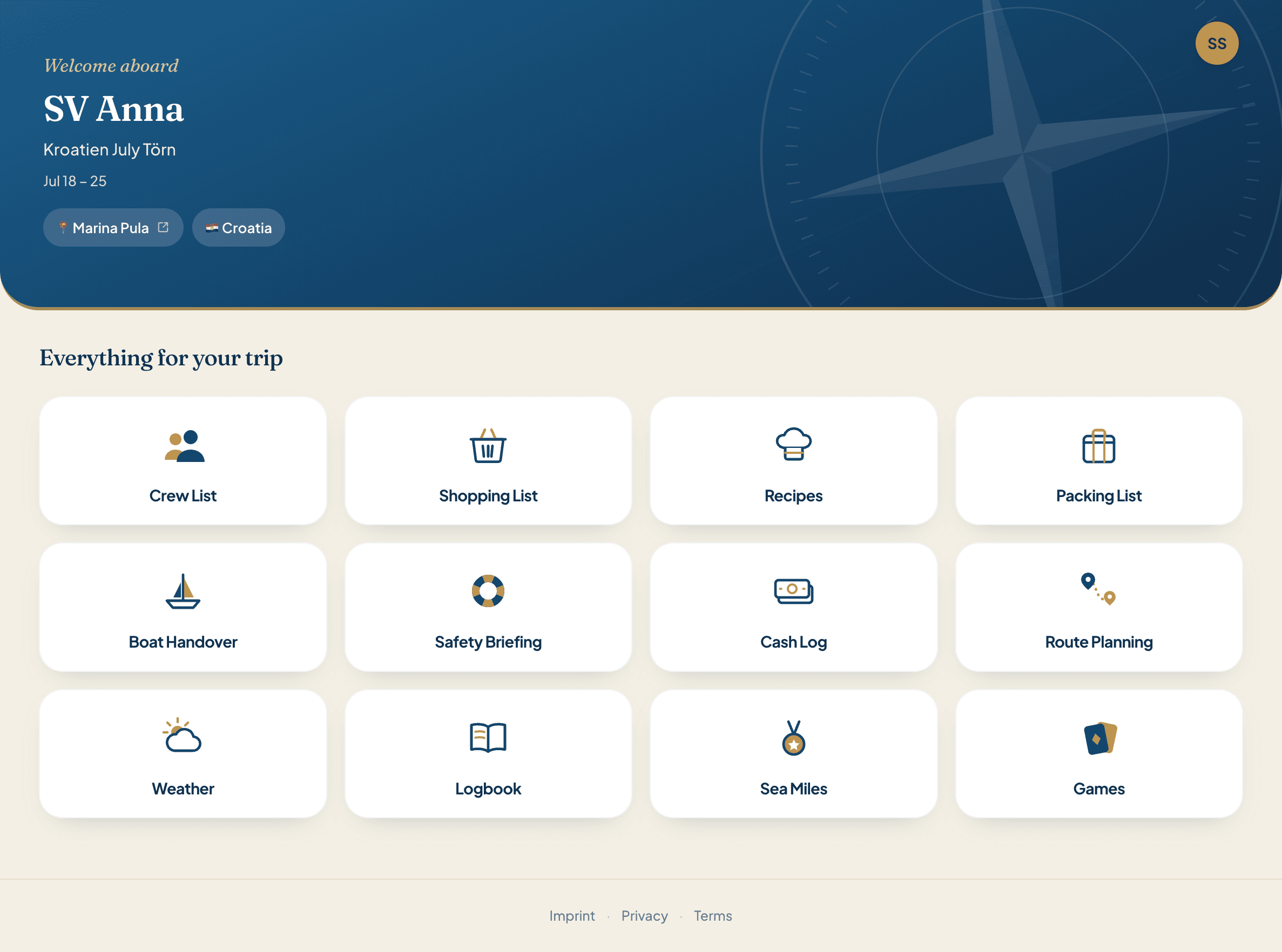
Pack, organise, shop, cook, navigate, settle up. Twelve features, one account. No more spreadsheets.
The route is set. And the rest?
Route planning, crew list, packing list, shopping list, recipes, boat kitty, logbook and mileage record. Twelve modules in one account.
Try it now